
Volunteer with Landcare group Friends of the Colo we paddle waterways using the groups equipment to map and treat weeds.
http://www.rivercanoeclub.org
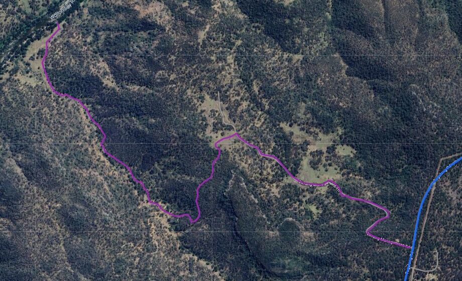
Dirrang Management Trail became an access point to the Wollondilly River after the acquistion of private property to form the Gulla Ngurra National Park . But there is a locked Gate at the enterance to the National Park off Tugalong Road. There is a managemnt trail for NPWS access for 3.8 kilometers down to the Wollondilly River. The track assends 300meters in the first 2.2 kilometers from the river.The advantage of this access point is the car shuttle is 26 kilometers (about 25 minutes) each way instead of the 72kilometer (1hour 15 minutes each way) car shuttle to the riverside access at the Nature Retreat which is downstream of the Wingecarriee Junction OR 31kilometers each way to the Limestone Creek Firetrail downstream.
As you walk up the management trail you need to take the left fork about 1.5kilometers up the track, so you do not walk up onto private property next to the National Park.

