
Posted by
Jon Mortimer manages the Eurobodalla Kayakers website and email list. Eurobodalla Kayakers is not a club. It is simply a facility for sharing information about some kayaking activities in the district, for kayakers who want to know when and where other paddlers might be found on the water. Further information, including a calendar of paddles, is available on the website (access via the link below) or via the email eurobodallakayakers[at]gmail.com
Eurobodalla Kayakers
SHARE URL:
Access Point Description:
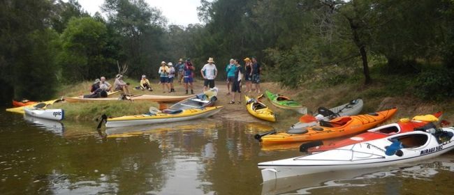
Grass and sandy bank access to the Moruya River from the end of Yarragee Road Moruya. Access to the car park is by mostly sealed road, with just a very small section of gravel road at the end that is suitable for all types of cars. Park in the car park and carry your kayak a short distance to the water. It is possible to launch from Yarragee at any time but there are shallow spots in the River so paddling is easier if low tide is avoided. No toilets or drinking water or shops/cafes here so stop in the town of Moruya on the way there or back.
ROAD ACCESS:
Unsealed
LAND TENURE:
Council Managed
CLOSEST MAIN ROAD:
Yarragee Road
WATER ACCESS:
Access off sand/bank
DISABLED ACCESS:
DISABLED ACCESS DESCRIPTION:
View in Waterways Guide Explorer
Latitude:
-35.907557139542
Longitude:
150.032100174310
Media
Eurobodalla Kayakers at Yarragee
Jon Mortimer
Wednesday, April 30, 2014 - 04:52