
Posted by
Jon Mortimer manages the Eurobodalla Kayakers website and email list. Eurobodalla Kayakers is not a club. It is simply a facility for sharing information about some kayaking activities in the district, for kayakers who want to know when and where other paddlers might be found on the water. Further information, including a calendar of paddles, is available on the website (access via the link below) or via the email eurobodallakayakers[at]gmail.com
Eurobodalla Kayakers
SHARE URL:
Access Point Description:
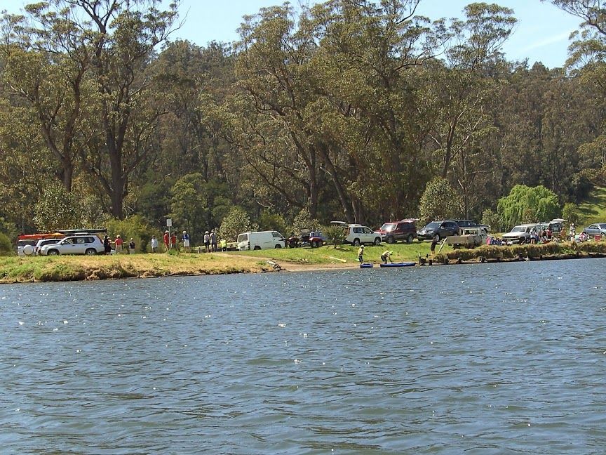
Snake Flat Reserve provides access to the Tuross River for flatwater paddling upstream, downstream or into Bumbo Lake. Turn west from the Princes Highway onto Bumbo Road. Travel 1km down Bumbo Road. A cattle grid and yellow "no camping" sign identifies the entrance to Snake Flat Reserve on your left. No facilities here but good cafes in Bodalla 3.7km drive further south on the Princes Highway.
ROAD ACCESS:
Unsealed
LAND TENURE:
Council Managed
CLOSEST MAIN ROAD:
Bumbo Road, off Princes Highway
WATER ACCESS:
Access off sand/bank
DISABLED ACCESS:
Need Assistance
DISABLED ACCESS DESCRIPTION:
View in Waterways Guide Explorer
Latitude:
-36.057867889886
Longitude:
150.042008254400
Media