
Berrima Camp Ground to MacArthurs Crossing Wingecarribee River
Posted by

Volunteer with Landcare group Friends of the Colo we paddle waterways using the groups equipment to map and treat weeds.
http://www.rivercanoeclub.org
Volunteer with Landcare group Friends of the Colo we paddle waterways using the groups equipment to map and treat weeds.
http://www.rivercanoeclub.org
SHARE URL:
Latest water level:
1.06 m
Level update time:
04-Jul-2026 06:30
WATERWAY:
Wingecarribee River
ENTRY POINT:
EXIT POINT:
AVERAGE GRADE:
Grade III
HIGHEST GRADE:
Grade IV
TRIP DURATION:
5-8 hours
TRIP LENGTH:
14 km
Gradient:
Hot Tip:
Prepare for icy conditions in winter
Maps:
Shuttle Length:
15km
Portage?:
Yes
Description:
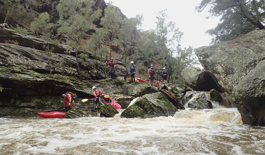
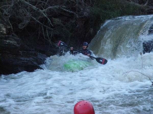
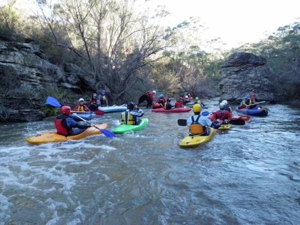
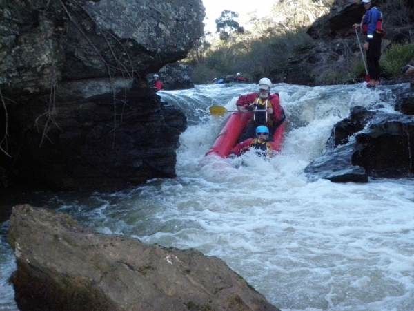
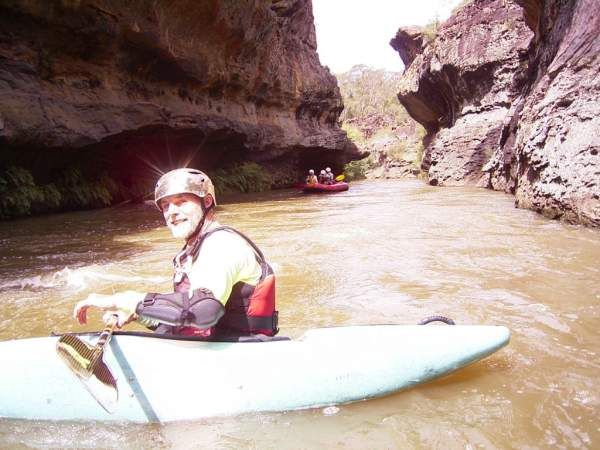
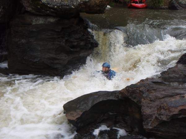
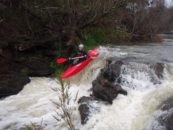
This river now needs rain, as pumping water from the Kangaroo River to eventually feed into Warragamba Dam is unnecessary thanks to desalination and much rain rains falling in the catchment area. You can warm up on the first few kilometres of flat water, and marvel at the scenery and lack of Willows. This has to be one of the recent success stories where man has done a good job and cleared the rapids which were once so choked it made the river dangerous and unpaddleable. As another bonus, you will most likely get a quick glimpse of a platypus. The river then picks up speed as it drops away through some spectacular rock formations. The river bed is pocked with holes and swimmers must be reminded to never stand in a rapids for fear of foot entrapment. The river has many 1 - 2 metre drops, which behave very differently at the various water levels. The river continues to pick up with many very interesting approaches to rapids. The little Gorge is a spectacular site and play place to wonder at nature. There may be an exit at Birchall's Lane if permission is sought or have your lunch and prepare for the rapids to become more technical as you proceed to MacArthurs Crossing. Portaging is done on river right as there are a number of rapids that are approaching Grade 4. On the shuttle run we usually put a marker on the river bank so we can spot the pull out. Emergency pull outs are through private properties that have tracks to the river, both are river right. First on is a property called Broomilaw at the end of Liebmanns lane and the second on is on the upstream side of where Mandemar creek joins the Wingecarribee. Topographic map is Mittagong
Media
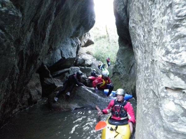
Mandatory portage in the second half
David Burgess
Wednesday, August 12, 2015 - 07:20
wingecarribee @ 1.22
David Burgess
Thursday, July 30, 2015 - 00:32
the second half of this is the Nepean Pheasants nest to Douglas park @ .85
NSW Canoe Guide
Wednesday, April 30, 2014 - 04:52
NSW Canoe Guide
Wednesday, April 30, 2014 - 04:52
NSW Canoe Guide
Wednesday, April 30, 2014 - 04:52