Canoe Creek To Bob Turner Track
Posted by

Published by: The Paddle NSW Inc. PO Box 6971 Silverwater NSW 2128 First published as a book "Canoeing Guide to New South Wales" in 1990 by NSW Canoe Association Incorporated Original Copyright NSW Canoe Association Incorporated 1990 Copyright PaddleNSW Inc. PO Box 6971 Silverwater NSW 2128 Email: admin@paddleNSW.org.au The information on this page and the printed book "Canoeing Guide to New South Wales" is copyright. Apart from fair dealing for the purposes of private study, research, criticism, or review as permitted under the Copyright Act, no part of this page may be reproduced, stored in a retrieval system or transmitted in any form or by any means electronic, mechanical, photocopying, recording or otherwise, without the prior permission of Paddle NSW Inc. All correspondence concerning the content of this guide should be addressed to the Paddle NSW Inc. ISBN O 646 00264 3 The "Canoeing Guide to New South Wales" was printed in Hong Kong by: United League Printing (Hong Kong) Ltd. , Film Separations by: D & S Brandish Print Consultants Typography by: Deblaere Typesetting Pty Ltd., Dee Why, NSW 2099
The Canoeing Guide to NSW Rivers
SHARE URL:
Latest water level:
0.94 m
Level update time:
14-Jun-2026 07:45
WATERWAY:
Colo River
ENTRY POINT:
EXIT POINT:
AVERAGE GRADE:
Grade III
HIGHEST GRADE:
Grade IV
TRIP DURATION:
8 - 10 hours paddling, Walk in 2-4 hours
TRIP LENGTH:
28 km
Gradient:
0
Hot Tip:
The sandstone cliffs of the gorge are high and precipitous and the gorge very narrow so that during the short days of the cooler months little, if any, sun penetrates to the river, making the trip very cold.
Maps:
Shuttle Length:
Portage?:
No
Description:
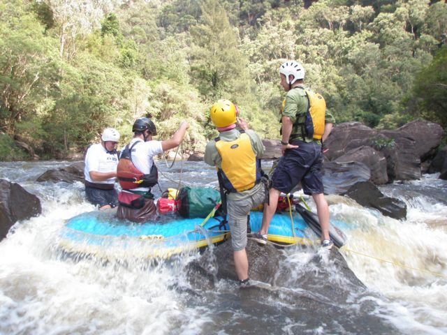
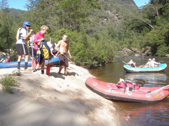
Access to the river is via a long, ill-defined walking track through thick scrub and washed out in places. This makes it difficult to walk in carrying or dragging a hard-shell kayak. Many people paddle this section in packrafts or on lilos. However you need to buy a quality raft or lilo and take a repair kit. The coarse sandstone rocks in the rapids and gnarly vegetation will tear holes in cheap plastic boats and lilos, such as Kmart or other cheap brands of rafts and lilos. This will leave you with a long, difficult walk along the bank through difficult vegetation, or having to swim the ponds with your pack in tow, changing this amazing adventure in the Wollemi Wilderness into a hard, tiring slog. If you do not have quality packrafts (usually they cost $800+) do not attempt this trip.
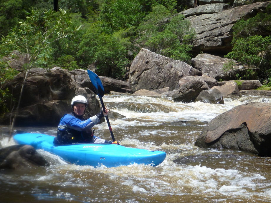
This is scenically one of the most spectacular paddles in NSW. The narrow gorge and precipitous 400m cliffs at the beginning of the trip are awe inspiring. Because of the nature of the terrain, good campsites along the river are difficult to find and may have to be levelled out of sand up the slopes beneath the cliffs. There is little grass to camp on, especially for some years after a major flood. Wildlife in this section is very scarce. The country changes substantially when the river emerges from the gorge when bush trees line the banks and more wildlife can be seen. Due to hidden sieves extra caution must be taken at the King rapid.
Use the rainfall gauges linked to this section you will see there is a list of gauges for the Colo catchment but you also need to look at the Bilpin and Kurrajongs heights gauge on the Grose catchment so you can get an idea of how widespread the rain has been across the catchment. If you see rainfall of 30 to 40mm on most of the gauges on a day or over a couple of days the river should get above the 1.1m at Upper Colo. 1.2 metres at the Upper Colo gauge is the river flowing bank to bank i.e. covering the sand bars at upper colo. So the height above that represents how deep the water will be generally across the river. Once it gets over 1.4 the water will be flowing through some in stream vegetation and so anyone that capsizes may get tangled up in it. Above 1.5m the water starts to flow quite fast and finding a spot on the tree lined bank can be a little difficult and so people who have capsized might get tangled up in trees trying to get to the bank to empty their boat.
A rough guide to how long the rain in the following gauges takes to get to upper Colo gauge is:
Glen Alice Capertee River 3 to 4 days
Putty (Carpenter) Wollemi Creek 2 to 3 days
Putty Tea Rooms Wollemi Creek 2 to 3 days
Putty The Gibba Wollemi Creek 2 to 3 days
Colo Heights Upper Colo Same day
Ben Bullen Wolgan River 3 to 4 days
Bilpin (Fern Grove) Wollangambe Creek 1 to 2 days
Kurrajong Heights Wheeney Creek never