
Abercrombie Bridge To Wyangala Storage
Posted by

Published by: The Paddle NSW Inc. PO Box 6971 Silverwater NSW 2128 First published as a book "Canoeing Guide to New South Wales" in 1990 by NSW Canoe Association Incorporated Original Copyright NSW Canoe Association Incorporated 1990 Copyright PaddleNSW Inc. PO Box 6971 Silverwater NSW 2128 Email: admin@paddleNSW.org.au The information on this page and the printed book "Canoeing Guide to New South Wales" is copyright. Apart from fair dealing for the purposes of private study, research, criticism, or review as permitted under the Copyright Act, no part of this page may be reproduced, stored in a retrieval system or transmitted in any form or by any means electronic, mechanical, photocopying, recording or otherwise, without the prior permission of Paddle NSW Inc. All correspondence concerning the content of this guide should be addressed to the Paddle NSW Inc. ISBN O 646 00264 3 The "Canoeing Guide to New South Wales" was printed in Hong Kong by: United League Printing (Hong Kong) Ltd. , Film Separations by: D & S Brandish Print Consultants Typography by: Deblaere Typesetting Pty Ltd., Dee Why, NSW 2099
The Canoeing Guide to NSW Rivers
SHARE URL:
WATERWAY:
Abercrombie River
ENTRY POINT:
EXIT POINT:
AVERAGE GRADE:
Grade II
HIGHEST GRADE:
Grade III
TRIP DURATION:
2 days
TRIP LENGTH:
40 km
Gradient:
0
Hot Tip:
Be prepared and equipped for maybe cold wet night in isolation. Check Storage level.
Maps:
Shuttle Length:
The car shuttle via Lyndhurst and Quart Pot takes 2 hours each way approx120km.
Portage?:
Yes
Description:
The river in this section is small to medium sized, dependent upon good local rainfall to make it canoeable. This trip will be an overnight trip by average paddlers and as such the paddlers must be totally self sufficient as this area is not accessible by road. The nights can be cold, especially if you get wet. This section has surprised many travellers for its difficulty factor, both with low water (portage) or high water (Damage.) Campsites are where you find them.
At low water levels the many exposed rocks are very sharp and quickly damage fibreglass boats: The first 12-14km contain the only rapids as the river passes through rugged, scrubby country with many exposed cliff faces. The rapids are grade 2-3 depending upon water levels and are all fairly straightforward. In high water this first stretch is very exciting with large standing waves and numerous small stoppers. About 7km from the bridge there is a large stopper at the head of a right-hand channel. It is possible to paddle through this but one needs to be prepared as it comes up unexpectedly. A swim at high water levels could be very long and possibly dangerous. Also rescues would be difficult in places with the tree-lined banks. A few kilometres further downstream below the stopper is a small haystack. The play-wave here is strong enough to nose stand a kayak. Leaving the whitewater behind the country opens up to large semi-cleared hillsides. In wet weather numerous waterfalls of brown muddy water cascade down the steep hillsides. The river now widens further as you enter stored water. This varies with dam storage levels. At the end of the trip the water is very wide, a couple of hundred metres in fact. Piesley's Creek is easily recognised. As vehicle access permission is difficult to obtain in this area it recommended that the paddler continue on to the Junction of the Lachlan and Abercrombie rivers. At the junction the first large bay on your right takes you to Quartpot, which is an ideal camping spot for the waiting vehicle crew who have driven in from Lyndhurst by open gravel public road. This area is part of the Wyangala Recreation area and managed by that group. A Powered vessel with the pick up crew is recommended to travel the stored water to meet the paddling group to determine the paddlers situation. No services exist in the back waters of the recreation area. Park Management may or may not patrol this area. You may be alone out of season. Be aware where you are, to determine the distance to assistance or services. Grabine Recreation park is across the otherside of the Junction. Wyangala is 10mins by powerboat, 45mins by gravel road. Do not attempt this section unless you are fully aware and prepared. Top water level takes the stored water to approx. GPS co-ord 33.98301 - 149.19927. NOTE: see utube Abercrombie river 2012 after flood
Media


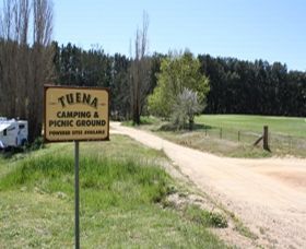
Tuena camping
LachlanPaul
Sunday, October 2, 2016 - 02:31
Tuena camping. Community run camping area, on the Tuena creek. upstream from the Abercrombie.
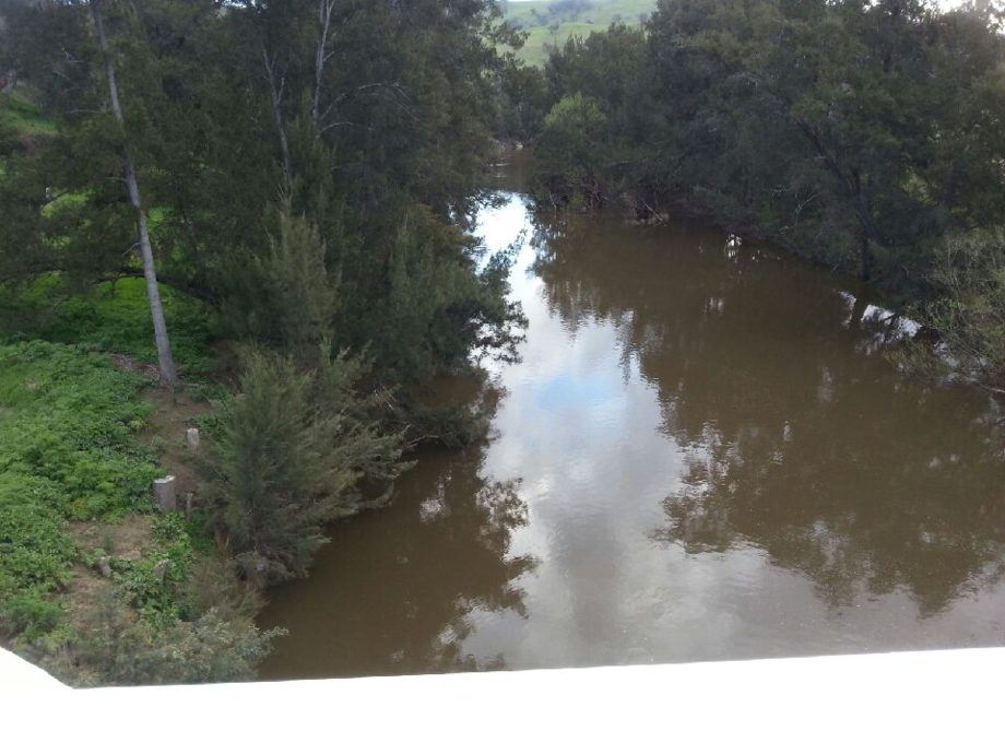
Abercrombie river at Abercrombie bridge Sept 2016
LachlanPaul
Sunday, October 2, 2016 - 01:54
Abercrombie river at Abercrombie bridge Sept 2016 with river height at 2m
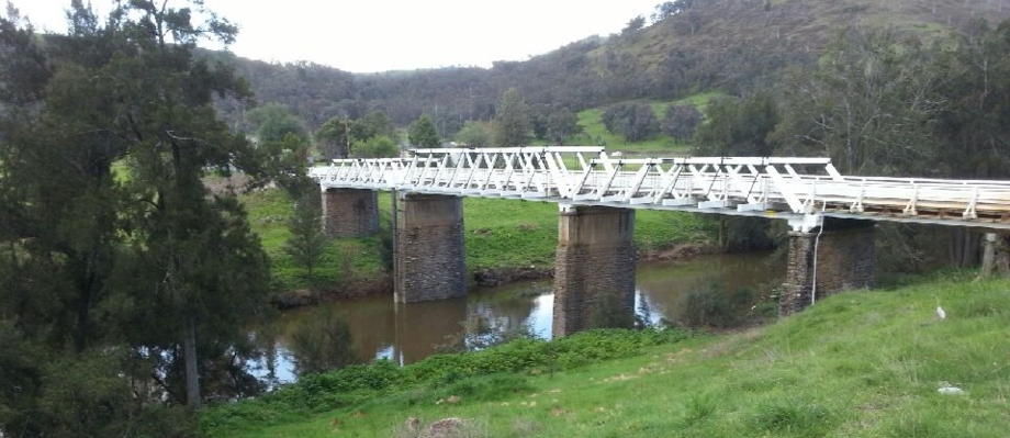
Abercrombie Bridge sept 2016
LachlanPaul
Sunday, October 2, 2016 - 01:50
Abercrombie Bridge sept 2016 with river in hi flow at 2m
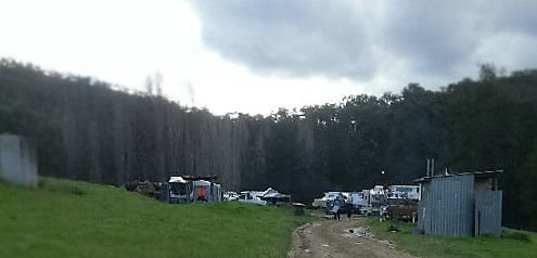
Abercrombie Campers 30 Sept 2016
LachlanPaul
Sunday, October 2, 2016 - 01:45
Abercrombie Campers 30 Sept 2016 with river at flood levels. 30 sept river was at 2m rising over night to 3.2m 1 oct.
Abercrombie River 2012 after flood
LachlanPaul
Tuesday, June 21, 2016 - 04:50
Abercrombie River after Flood shows the river and its difficulties
Abercrombie To Wyangala Storage
LachlanPaul
Wednesday, March 9, 2016 - 23:28
camping at the Abercrombie bridge camping area
Abercrombie To Wyangala Storage
LachlanPaul
Wednesday, March 9, 2016 - 23:26
Access to this section is from Abercrombie bridge on Bathurst to Goulburn rd outside Trunkey creek. Accommodation in Trunkey, Abercrombie caves reserve or riverside camping downstream of bridge.