
05. Carcoar to Mandurama Burnt Yards Road,Fagans Bridge
Posted by
SHARE URL:
Latest water level:
0.45 m
Level update time:
24-May-2026 09:45
WATERWAY:
Belubula River
ENTRY POINT:
EXIT POINT:
AVERAGE GRADE:
Grade I
HIGHEST GRADE:
Grade I
TRIP DURATION:
1 day
TRIP LENGTH:
20km km
Gradient:
Hot Tip:
Make sure adequate water at both ends before you start
Maps:
Shuttle Length:
11km
Portage?:
Yes
Description:
This river is very narrow and meandering. The flow depends on the output of Carcoar Dam and rain from the Orange/Cadia catchment. The flow here can be vastlydifferent volumns from further up river..
08/03/2016 Photos show river with an average flow of 0.84 for a week and the river is vertually stopped at Canowindra. Photos show Fagans Bridge levels on 08/03/2016 with Carcoar river gauge at .90m. and Dam release at average of 47ml/d over last 5 days.
River is very heavly treed and areas of difficulty may be found with these as with farmers fences. See Ashburton Bridge access as way point.
The Belubula River is a triburary of the Lachlan River
Media
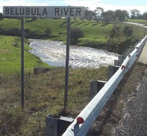

Fagans bridge,Belubula River, 21/Jul/2016 upstream
LachlanPaul
Thursday, July 21, 2016 - 11:54
Fagans bridge,Belubula River, 21/Jul/2016 upstream. The gauge used is the Carcoar village gauge which is misleading at this point. Check the Needles gauge ((412056) which is quite some distance downstream. Visual inspection to determine water volume at tho point is recommended.
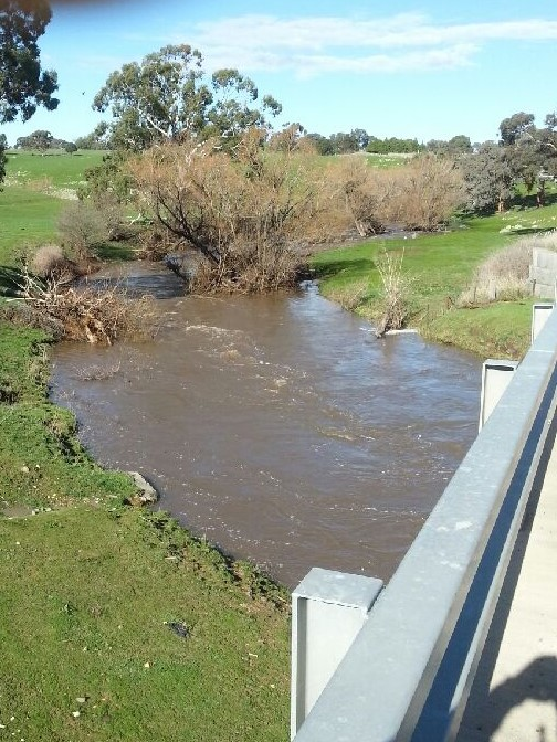
Fagans Bridge, Belubula river, 21/jul/2016
LachlanPaul
Thursday, July 21, 2016 - 11:44
Fagans Bridge, Belubula river, Downstream, 21/jul/2016, River in Flood. River gauge used is Carcoar Village. Incorrect data for this point of the river. Next gauge is the Needles (412056) which can also be miss leading. Physical check is required to determine water volume.
Ashburton Bridge - Errowanbang rd.
LachlanPaul
Thursday, March 10, 2016 - 06:13
Ashburton Bridge - way point on this section or exit/entry point