
Higher MacDonald to Piggyback Bridge
Posted by

Volunteer with Landcare group Friends of the Colo we paddle waterways using the groups equipment to map and treat weeds.
http://www.rivercanoeclub.org
Volunteer with Landcare group Friends of the Colo we paddle waterways using the groups equipment to map and treat weeds.
http://www.rivercanoeclub.org
SHARE URL:
Latest water level:
2.75 m
Level update time:
30-Jun-2026 08:35
WATERWAY:
Macdonald River (Hawkesbury)
ENTRY POINT:
EXIT POINT:
AVERAGE GRADE:
Grade I
HIGHEST GRADE:
Grade I
TRIP DURATION:
TRIP LENGTH:
6km km
Gradient:
Hot Tip:
Maps:
Shuttle Length:
Portage?:
Description:
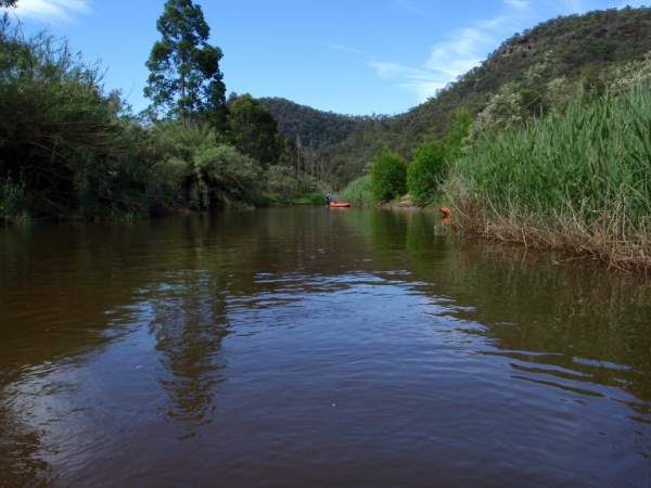
The river is sandy bottom and flows through farm land where livestock graze across the river and so the banks are clear. Although there are some properties not grazed and the river also runs next to the Yengo NP is places. So there are some area on good native vegetation. Howver there are several fences across the river (barbed wire and electic) but they are generally only one or two strands but are support by star pickets midstream. These fences keep the livestock from grazing the riparian vegetation on adjoining properties. Phragmities dominates the both sside of the river and so you will see lots of native birds on the macDonald. the river is shallow and sandy for most of the trip.
This section is only short but split off from the next section as the river narrows slightly after piggy back bridge and tends to be a little deeper and so easier to paddle.
