
Dardanelles Bridge To Thora
Posted by

Published by: The Paddle NSW Inc. PO Box 6971 Silverwater NSW 2128 First published as a book "Canoeing Guide to New South Wales" in 1990 by NSW Canoe Association Incorporated Original Copyright NSW Canoe Association Incorporated 1990 Copyright PaddleNSW Inc. PO Box 6971 Silverwater NSW 2128 Email: admin@paddleNSW.org.au The information on this page and the printed book "Canoeing Guide to New South Wales" is copyright. Apart from fair dealing for the purposes of private study, research, criticism, or review as permitted under the Copyright Act, no part of this page may be reproduced, stored in a retrieval system or transmitted in any form or by any means electronic, mechanical, photocopying, recording or otherwise, without the prior permission of Paddle NSW Inc. All correspondence concerning the content of this guide should be addressed to the Paddle NSW Inc. ISBN O 646 00264 3 The "Canoeing Guide to New South Wales" was printed in Hong Kong by: United League Printing (Hong Kong) Ltd. , Film Separations by: D & S Brandish Print Consultants Typography by: Deblaere Typesetting Pty Ltd., Dee Why, NSW 2099
The Canoeing Guide to NSW Rivers
SHARE URL:
Latest water level:
1.71 m
Level update time:
24-May-2026 08:30
WATERWAY:
Bellinger River
ENTRY POINT:
EXIT POINT:
AVERAGE GRADE:
Grade II
HIGHEST GRADE:
Grade III
TRIP DURATION:
2 day trip
TRIP LENGTH:
30 km
Gradient:
0
Hot Tip:
Maps:
Shuttle Length:
Portage?:
No
Description:
The Bellinger is a small yet very beautiful river which rises on the eastern escarpment of the New England National Park near Ebor. It flows east under the escarpment formed by the Dorrigo plateau, passing through the township of Bellingen to enter the sea near Urunga. Although it has only a small watershed, it rises in an area of consistently high rainfall which ensures a reasonable flow through most of the year while at the same time creating problems of access, as there are many fords to be negotiated in getting to a reasonably high put-in point.
This is the only feasible white-water section of the river as above Dardanelles Bridge access is difficult and below Thora there are only occasional gravel races and the river is rather uninteresting. It is an easy two day trip with many grade 1-2 rapids.
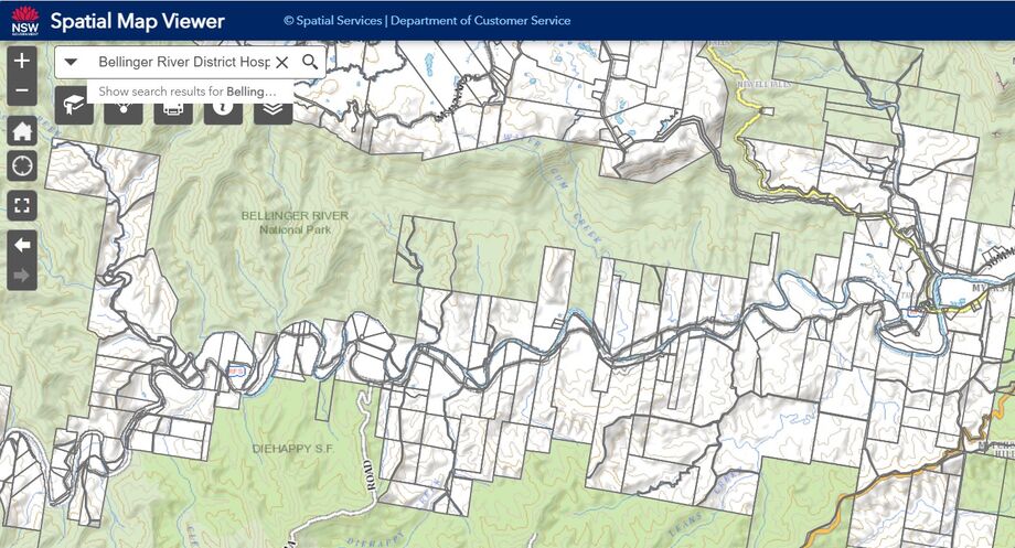
This is a very twisty river which offers beautiful glimpses of mountains and forests with the Bellinger River State Forest to the north and Die happy State Forest to the south. The best rapids in the section are between Cleavers Crossing (Map Ref. 665327) and Orana church (Map Ref. 702328). This stretch of 8km can make a pleasant alternative short day trip. There are numerous suitable campsites but permission should be sought before camping as some landowners do not welcome visitors. Alternatively checkout the NSW Spcial Map Viewer web site and try to lan your overnight camps on National PArk Estate. Care should be taken when approaching low-level bridges or floating water-driven pumps. When their is a lot of rain the river rises very quickly cutting off access and also the river becomes very fast flowing and so increases in difficulty and so should not be paddled in those conditions. We do not have any recommended river levels
Media
map showing NPWS estate
jeffcottrell
Monday, March 18, 2024 - 06:58