You can start using the website right away; Explore using the Index or Map.
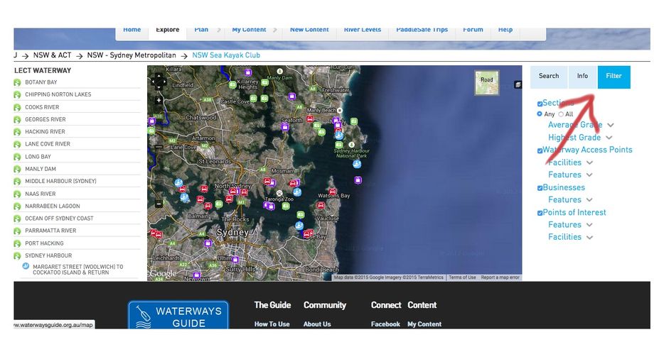
If this is your first time, start your tour by navigating round the map. The Waterways Index when opened will provide Access Poins and trip suggestions called Sections. The map defaults to access points (red dots) and trip suggestions (blue dots). If you want information specific to freshwater anglers or canyons, then you will can Filter these options. The same will apply to related businesses - equipment hire, accommodation, clubs and places to learn more about the sport.
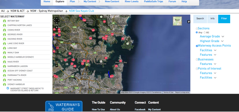
Select Filter Tab on right of map. A category index will be displyed. Each category has sub groups, the type/grade of water, whether the access point has fresh water or barbecues for example. Uncheck those categories you are not interested in and they will disappeaar from the map.

For example Filter to only display Access to the water.

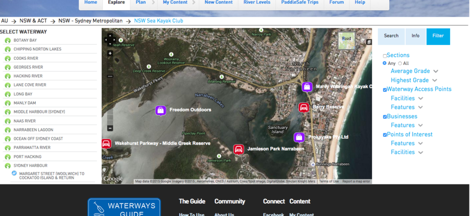
Hone in on the map to see the name of a waterway or river, access point name or boat ramp.

SEARCH by entering the name of a waterway or access etc.
The ADVANCED SEARCH, can be used to filter/select special features: toggle between Filter, Search and Info. If you wish to return to a preious search, then use the breadcrumbs which can be found just above the index to the left.
Explore using the Filters and the map index.
Flat, white or open water,Trip Grades, Access points and special features (parking, toilets, drinking water etc), day trips, muti day trips , Businesses, Canoe Clubs, accommodation and much more
Enter NEW SOUTH WALES and a list of regions will be displayed. These regions were chosen becasue they pretty closely follow water catchment areas.
Pick a REGION from the list or by directly selecting the area on the map. A list of Waterways will replace the Region list and the map will zoom into the Waterways. A waterway can be any body of water or river where suggested journeys (paddling trips) have been identified.
Look more closely at a WATERWAY and you will find as you scroll over the water it can be subdivided. These smaller sections of the Waterway are called just that, SECTIONS. OR choose one from the list. Each SECTION has its own blue dot, complete with a KAYAK image. You can click on the KAYAKER and a summary of a trip will appear.
When you choose a SECTION the map will zoom for a closer look. The entry and exit points (RED DOTS) are CAR ACCESS POINTS and there are summaries of both access points and the paddling trip description replaces the list of Waterways. Use your map or lists on your screen for a speedy result.
When you scroll to seek more information., you will be asked to REGISTER. There will be no cost. The descriptions of the trip and the Waterways Community will open to you.
Look at the icons on the extended trip information. They will enable you to SHARE this page with friends, STAR the page to add to a list of favourites and print to take a copy on the trip with you.
At any time you minimise the detailed page or lists for a closer look at the map, you can back up using the breadcrumbs alon the top of the indoramtion, or start again by pressing home. Keep an eye on the map as you back up, as other Sections in the Region will show up.
Before PLANNING a trip use the Waterways Guide to check the current weather, tides, river heights, paddling distance and grade of the trip, facilities available at the waterways access points and a description, including some images of the area. There is already some accommodation, gear shops for equipment purchase and hire. Look for the "layer" to access where they can be found on the map.
Don’t forget to BE PREPARED and review the SAFE PADDLING section of the Waterways Guide. Plan your trip according to your ability; leave an emergency plan with someone you know.
If you know your way around the Waterways Guide, then there is a range of navigation tools available from the map.
The Advanced Search function to choose by Region, Waterway, Grade of paddle, access points, boats ramps, special points of interest is under development. Then you will be able to save your favourite rivers to your Profile.
The Sitemap at the bottom of the page can provide a quick link to much of the information.
Happy Paddlng from the Waterways Community.

