
Macs Crossing to Rock Flat Reserve
Posted by

Published by: The Paddle NSW Inc. PO Box 6971 Silverwater NSW 2128 First published as a book "Canoeing Guide to New South Wales" in 1990 by NSW Canoe Association Incorporated Original Copyright NSW Canoe Association Incorporated 1990 Copyright PaddleNSW Inc. PO Box 6971 Silverwater NSW 2128 Email: admin@paddleNSW.org.au The information on this page and the printed book "Canoeing Guide to New South Wales" is copyright. Apart from fair dealing for the purposes of private study, research, criticism, or review as permitted under the Copyright Act, no part of this page may be reproduced, stored in a retrieval system or transmitted in any form or by any means electronic, mechanical, photocopying, recording or otherwise, without the prior permission of Paddle NSW Inc. All correspondence concerning the content of this guide should be addressed to the Paddle NSW Inc. ISBN O 646 00264 3 The "Canoeing Guide to New South Wales" was printed in Hong Kong by: United League Printing (Hong Kong) Ltd. , Film Separations by: D & S Brandish Print Consultants Typography by: Deblaere Typesetting Pty Ltd., Dee Why, NSW 2099
The Canoeing Guide to NSW Rivers
SHARE URL:
Latest water level:
1.85 m
Level update time:
20-Jun-2026 11:45
WATERWAY:
Goobarragandra River
ENTRY POINT:
EXIT POINT:
AVERAGE GRADE:
Grade III
HIGHEST GRADE:
TRIP DURATION:
TRIP LENGTH:
2.5 km
Gradient:
0
Hot Tip:
This section has changed since floods in 2012
Maps:
Shuttle Length:
Portage?:
No
Description:
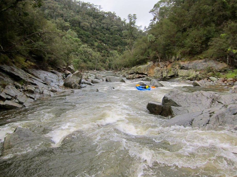
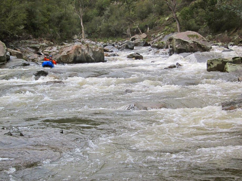
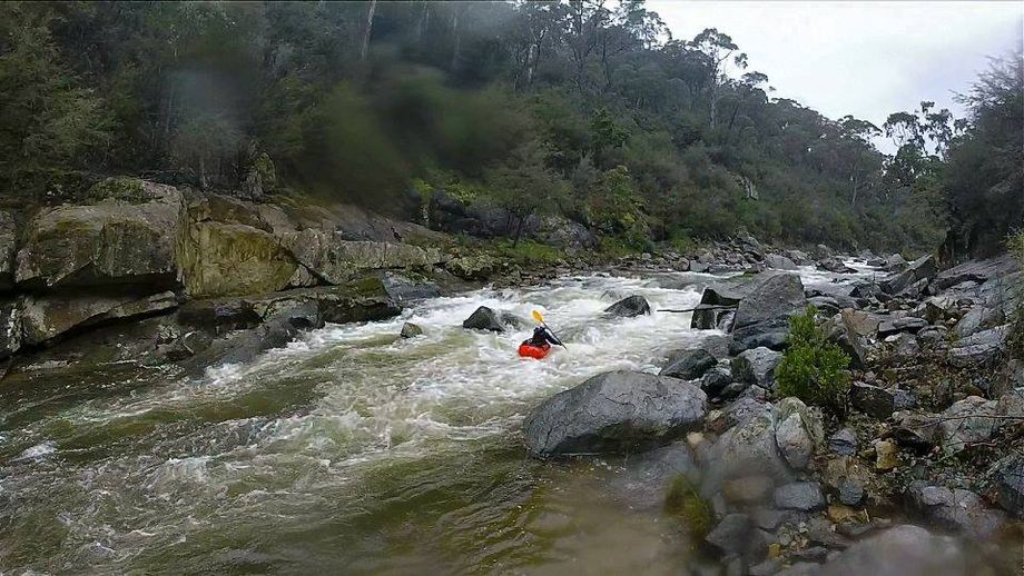
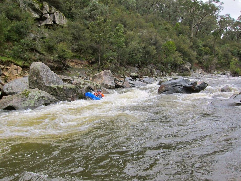
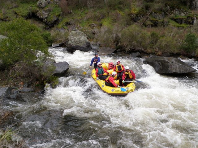
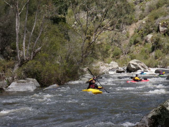
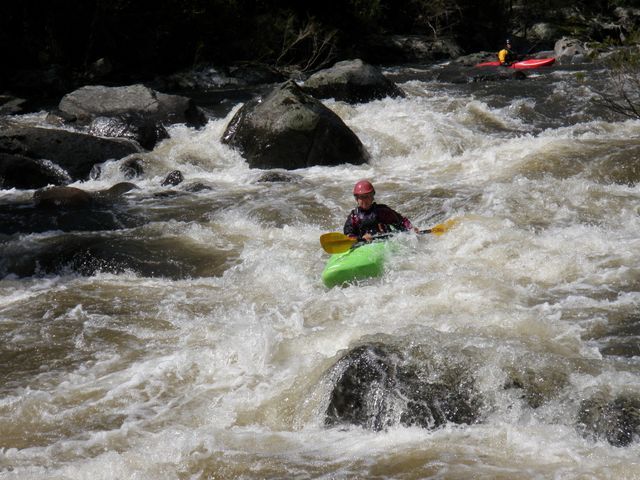
The river passes a magnificent stand of elms before being joined on the left by the Peak River. Following this is a long series of twisty grade 2 rapids. On entering the gorge a few hundred metres on, there is a quiet pool followed by a continuous stretch of good grade 3 rapids. This short, though rugged, gorge consists of a steep, boulder-strewn bed enclosed by high, rocky slopes which make access difficult. Many canoeists capsize in this stretch and have difficulty getting themselves and their craft out of the water. The rapids should be inspected before shooting and, if any of the party is tentative, rescue ropes made ready for throwing at strategic positions. The final rapid before the river emerges from the gorge cannot easily be inspected but usually causes little trouble even though it curves around a large boulder such that the line taken by early paddlers cannot be seen by those following. There is a large stopper at the bottom of this rapid but this does not normally hold craft as they travel at considerable speed over it. Shortly after this the river divides around a large island and it is best to take the left arm. This leads to a rocky run which ends in a pool at the Reserve.
Media
Goobarragandra Macs to Rock Flat at 1.5
jeffcottrell
Wednesday, May 11, 2016 - 22:59
Goobarragandra Macs to Rock Flat at 1.5
jeffcottrell
Wednesday, May 11, 2016 - 22:58
Goobarragandra Macs to Rock Flat at 1.5
jeffcottrell
Wednesday, May 11, 2016 - 22:58
Goobarragandra Macs to Rock Flat at 1.5
jeffcottrell
Wednesday, May 11, 2016 - 22:53