

Navua Reserve to the last rapid on the Grose River and return
Posted by

Volunteer with Landcare group Friends of the Colo we paddle waterways using the groups equipment to map and treat weeds.
http://www.rivercanoeclub.org
Volunteer with Landcare group Friends of the Colo we paddle waterways using the groups equipment to map and treat weeds.
http://www.rivercanoeclub.org
SHARE URL:
Latest water level:
0.67 m
Level update time:
24-May-2026 12:45
WATERWAY:
Grose River
ENTRY POINT:
EXIT POINT:
AVERAGE GRADE:
Grade I
HIGHEST GRADE:
Grade I
TRIP DURATION:
3-4HRS
TRIP LENGTH:
12KM km
Gradient:
Hot Tip:
Maps:
Shuttle Length:
Portage?:
No
Description:
This paddle is up the grose river from either Navua Reserve (GroseWold) or Yarramundi North Reserve. You can paddle upstream against the flow if the river is deep enough and have lunch or camp overnight on the sand banks near the last rapid. then paddle back down to Navua Reserve. If you are doing an overnight trip i would probably leave my vehicle along the road side outside Navua reserve at the gates get locked at sunset. Both Reserves are isolated and so cars left overnight might be vandalised. The walk from the car to the river is a little shorter at Navua resere than on the Yarramundi side of the river.
The river is usually a shallow sandy bottom river and so you have to find your way in the deeper channels over the sand. But i have enoticed after the 2013 floods the river has been scoured out and there are a lot more pools between the sand banks, so i imaging at lower flows you will need to walk over these sand banks. The river is a great example of how Australia rivers where prior to european settlement with large logs locking in the river bed and as there are no livestock on the adjoining properties the banks have native vegetation comeing right down to the river. And it is so close to Sydney. There are issues with Lantana and Bell Minor birds causeing die back in the tall gum trees but this is being addresses by the Local Land Services in partnership with the National Parks and Wildlife Services (NPWS) and private landowners starting from the upstream end. There was some work done by NPWS and Sydney Bass fishing club about 4 years back it that areas is now just pristine bushland
We paddled up the river when it was between 0.9m and 0.8m and it took about and 2 hours to paddle up the river to the last rapid and one hour to paddle back to Navua Reserve
You can still paddle the lower section of the Grose River during low flows as is tidal for about 2.5 kilometers upstream of the Hawkesbury Junction. So as the tide comes in you can paddle up the river on the incomming tide. If you look at the river level gauge at "North Richmond WPS" you can see when the tide causes the river level to rise. That rise in the river reaches the Grose River junction approximately 3.5 hours latter and then makes it to the tidal limit about 1 hour latter. Paddling on this section during the higher tide levels means the river is deeper over the sand and so a more enjoyable paddle and less walking in the soft sand. If you are planning ahead and looking at the north ricmond gauge today and planning he paddle on the weekend the tides are about 40 minutes latter each day. There is a tidal gauge at Freemans reach but when i planned my paddle it had a predicted low tide at a similar time that the river level gauge at north richmond actually started to river on the day i paddle. So I tend to rely on the north richmond gauge as a better indicator.
Media

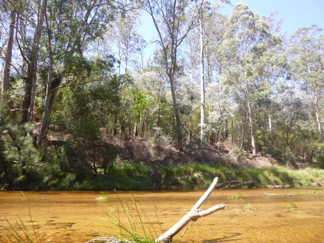


Grose river where Lantana was recently treated on the riverbank opposite the Sydney Bass regen site
jeffcottrell
Monday, December 15, 2014 - 02:14
Grose River Bushland that was restored by Sydney Bass members working with National Parks and Wildlife Services
jeffcottrell
Monday, December 15, 2014 - 02:12
Small sandy camp sites around the last few rapids
jeffcottrell
Monday, December 15, 2014 - 02:10
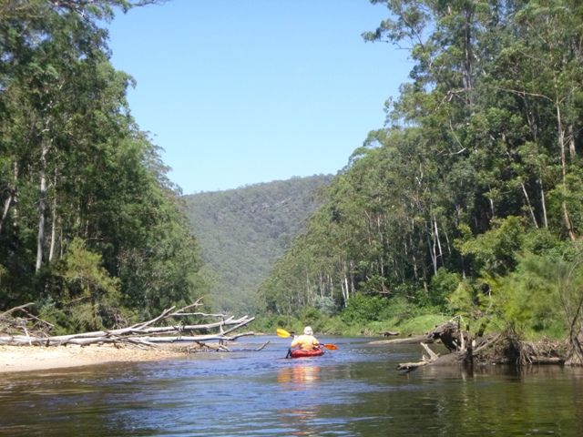
paddle off into the World Heritage Area
jeffcottrell
Monday, December 15, 2014 - 02:08
Paddling through Gross River phragmites reed beds
jeffcottrell
Monday, December 15, 2014 - 02:07
Paddle up the Grose River into the Blue Mountains National Park
jeffcottrell
Monday, December 15, 2014 - 02:05