
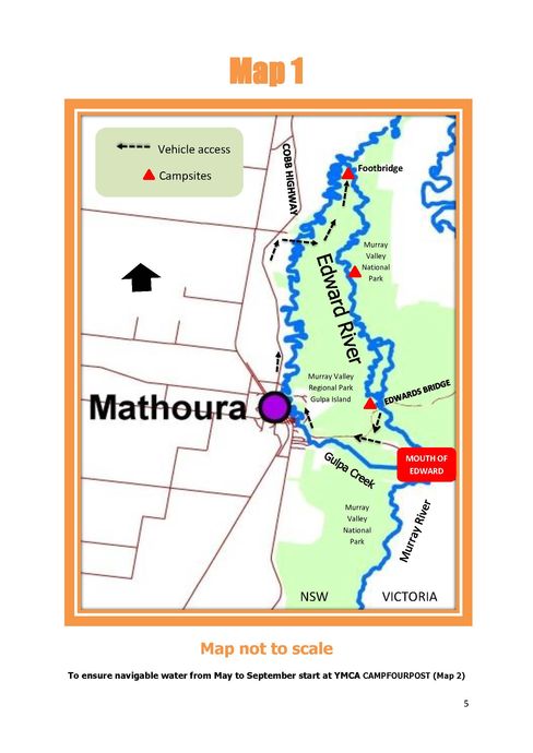
Edward Bridge to Hazelwood Road Footbridge
Posted by

Volunteer with Landcare group Friends of the Colo we paddle waterways using the groups equipment to map and treat weeds.
http://www.rivercanoeclub.org
Volunteer with Landcare group Friends of the Colo we paddle waterways using the groups equipment to map and treat weeds.
http://www.rivercanoeclub.org
SHARE URL:
Latest water level:
1.45 m
Level update time:
07-Jul-2026 12:00
WATERWAY:
Edward River
ENTRY POINT:
EXIT POINT:
AVERAGE GRADE:
Grade I
HIGHEST GRADE:
Grade I
TRIP DURATION:
8 -10 hours
TRIP LENGTH:
35 km km
Gradient:
Hot Tip:
Maps:
Shuttle Length:
29 km
Portage?:
No
Description:
Up to 8 hours depending on the river height. Between May & September when water levels are very low consideration should be given to starting at Map 2 or making an additional overnight stop because this section of water is heavily timbered. If travelling from Deniliquin follow the Cobb Highway 23 kms south of Deniliquin, take the dirt road into the forest at the Gulpa Walliston Road. Follow the road into Gulpa Island over Barkers Bridge then turn left at Junction Road. Continue to follow Junction Road & turn down Hazelwood Road to the river. It is a similar distance from Mathoura travelling north about 30 minutes.